Zanzibar Social Environmental Atlas for Coastal and Marine Areas
Project Members
ZanSea Team
A group of SUZA staff members in charge of Project management and technical implementation: Web Developers, web designers, database expert and thermaticians.
Statoil
A leading energy company in oil and gas production. Statoil has entered into MOU with SUZA to reinforce capacities in environmental management and Geographic Information System.
Obscom
A Geo-information and environment company. OBSCOM provides technical support to the project: Training, SDI architectures and enviromental expertise.
SUZA
Founded in 1999 and started its academic activities in 2001, With ZANSEA Project SUZA wants to develop its academic offer in Geographic Information Systems.
Project Description
What is ZanSea ?
ZANSEA has two main objectives.
To develop SUZA to become a national competence centre within management of environmental and social data using GIS.
To develop a SDI (Spatial Data Infrastructure) for sharing data and knowledge over Coastal and Marine Areas on Zanzibar.
DATA
Zansea Project has capacity to create marine and coastal dataset such as vector layers, raster files and tabular data. Datasets will follow international standards for metadata.
MAPS
ZANSEA will create Maps and make them available to partners and general public. Maps produced will be: Administrative maps, Coastal Resources Map, Vulnarability Maps, and enviromental sensitivity Maps.
SDI
Our SDI is built with the most powerful open source geospatial components. datasets are stored in spatial DBMS (PostGis), webservices (WMS,WFS and CSW) are provided by GeoServer. These softwares are the guarantee of the interoperability of our system. Mobile and web mapping applications can easily be deployed to give responce to our partner needs.
PARTNERSHIP
The following institutions have been invited to join the partership: DOE, DOEM, DOEFNR, SUZA, TMA, ZAWA, ZCT, IMS, OCGS, Museum and antiquities. There could be more partners in the future. .
Map Samples
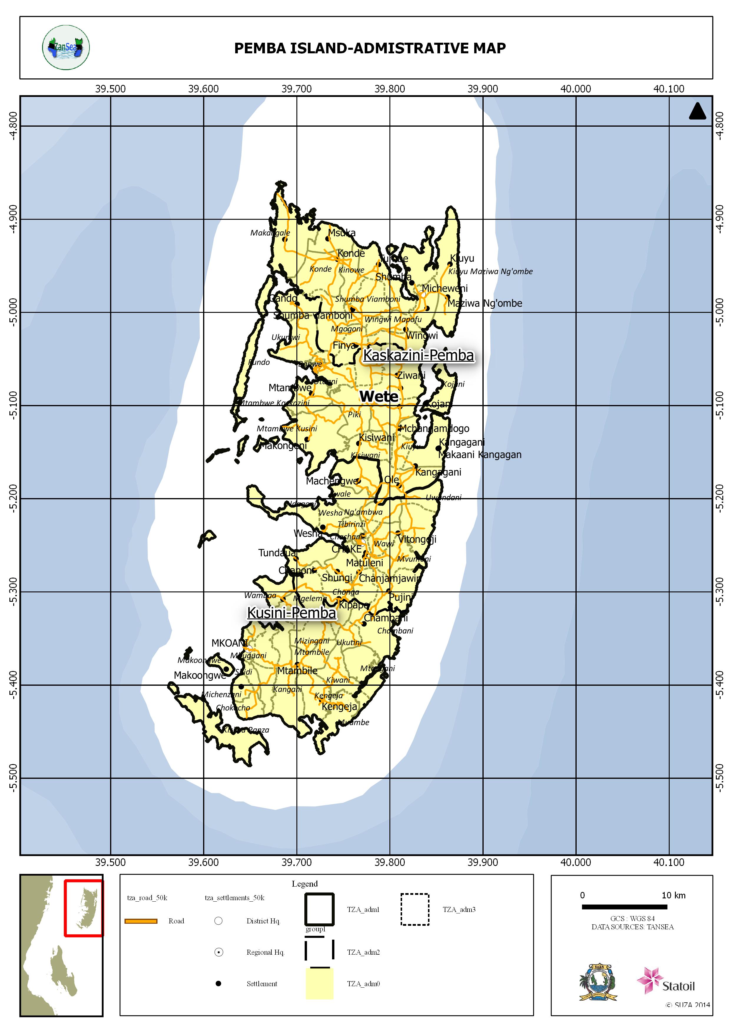
Pemba Island Administartive Map
Unguja Island Coastal Environmental Map
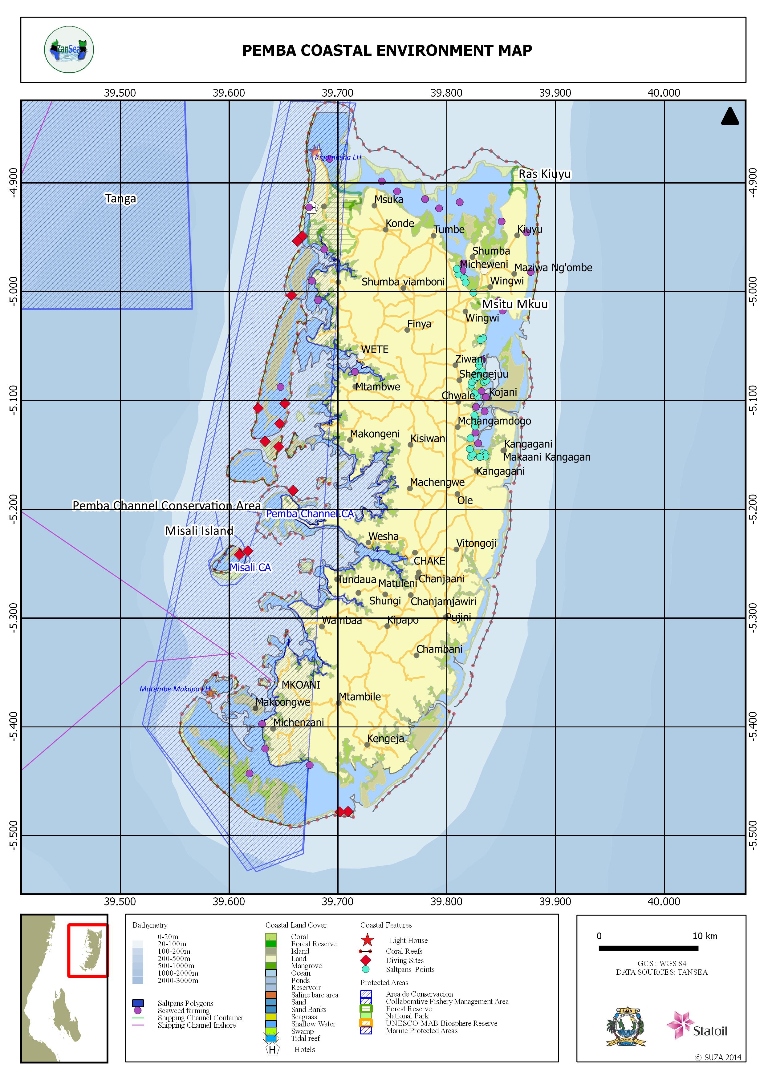
Pemba Island Coastal Environmental Map
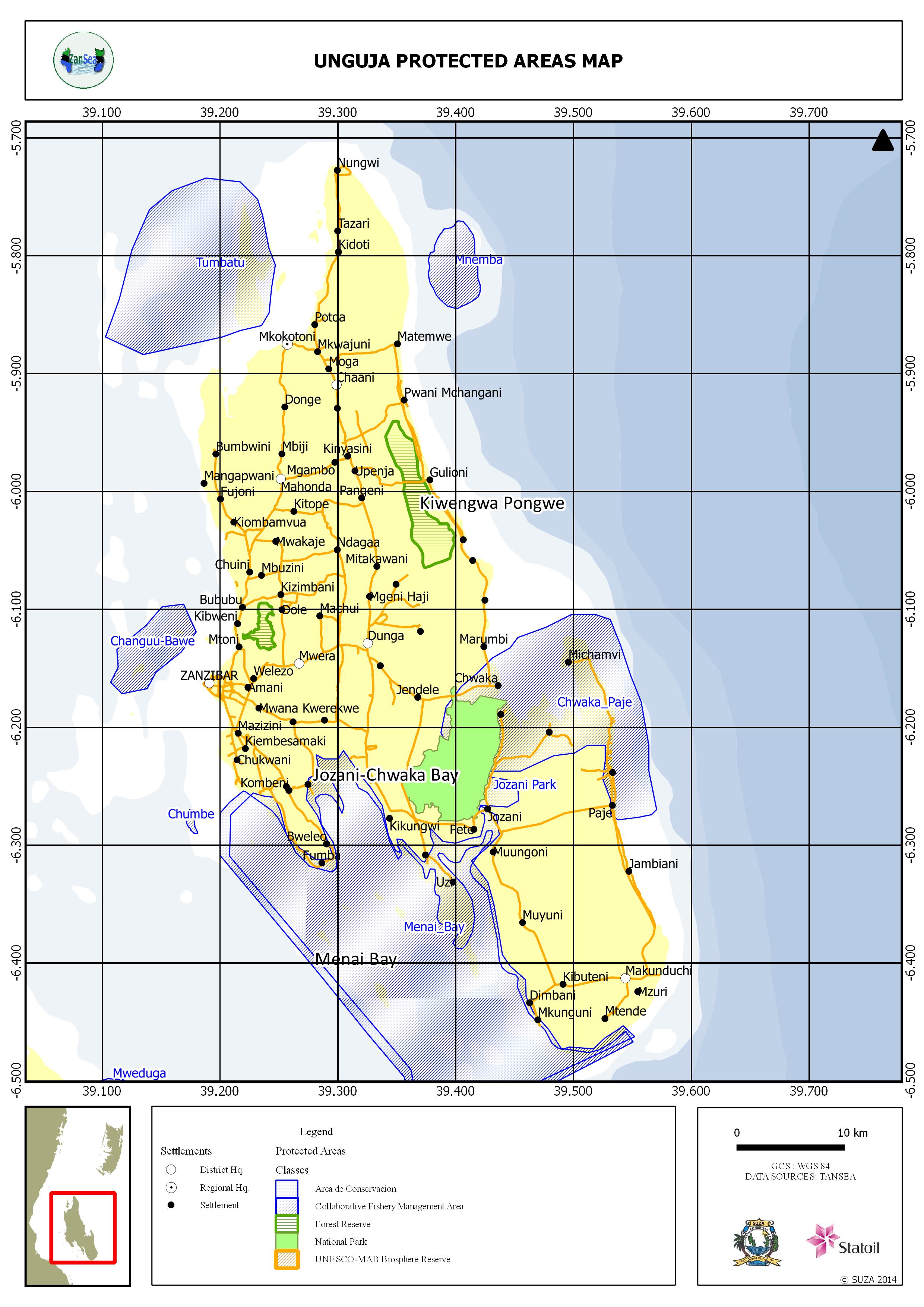
Unguja Island Protected Areas Map
Contact us
Looking forward to answering your email.
Where
The State University of Zanzibar (SUZA)
Tunguu Campus
Phone No:+255 000 000 000
Email zansea@suza.ac.tzOrganized by